|
|
|
|
|
|
|
|
|
DL2KCL solar eclipse 1999 in Europe (part 1)
|
|
|
|
|
homepage | longwave | solar eclipse 1999 | link-page | software
|
|
|
|
|
|

|
|
|
|
|
|
|
|
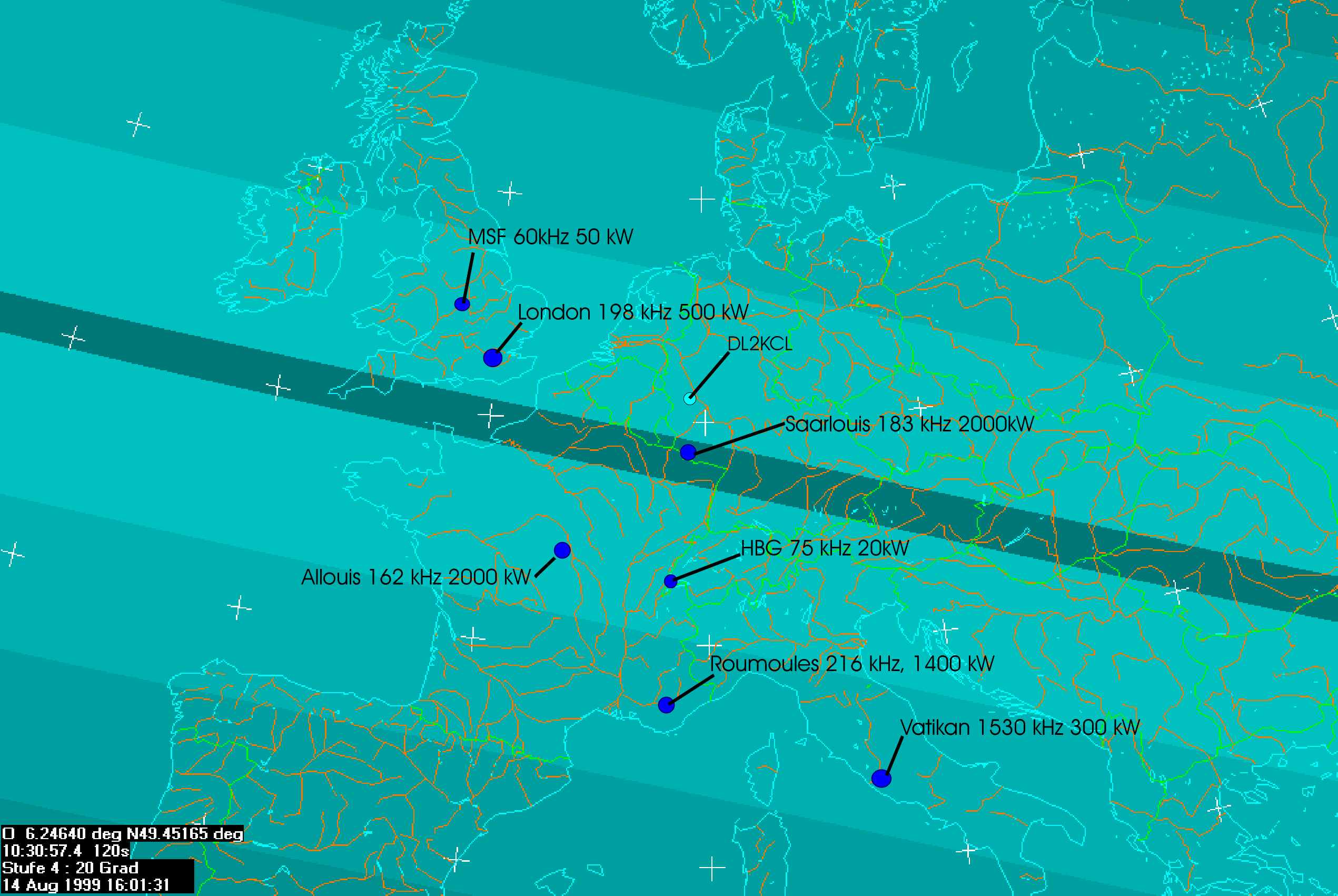
The path of the shadow-zone over central Europe 11. Aug. 1999
|
|
|
|
|
|
|
|
|
|
|
|
|
|
|
|
|
The map shows path of the moon-shadow over central Europe. The darkest path marks the zone of total eclipse which is about 110 km wide. Land´s End in Great Britain was hit by the maximum of the total eclipse at 12:13 MESZ and the borderline between Luxemburg and Germany at 12:31 MESZ.
- MESZ: mitteleuropäische Sommerzeit = UTC+2h -
This map was created by using the astronomy software "Guide 7.0"
|
|
|
|
|
|
|
|
|
|
|
|
|
|
|

|
|
|
|
|
|
|
|
|
|